On Halloween morning October 31, 2013 a massive flash flood ravaged the Austin area. In a day’s time, 2-14 inches of water was dumped around the Texas Hill Country, with most coming over a 6-hour period during the night. This flood spanned across 8 counties, and killed 6 people. The figure on the left, below shows the
amount of precipitation in the affected counties.
What
caused the severity of this flood during a period of drought in Texas? Many
individuals forget that just two weeks earlier a flood had occurred around the same area. This
flood dropped around 10 inches in the area over a daylong period. Due to the
accumulation coming over a longer period, the flood wasn't given as much
attention. But when the October 31st flood arrived, the water levels
of the various rivers, creeks, and aquifers were still high. This turned a bad
flood into a terrible one. Over 800 homes were damaged in the top three
affected counties of Caldwell, Hays, and Travis. Along with the
previous flood, the “Flash Flood Alley” traits all played a role. Hilly
topology combined with thin topsoil and exposed bedrock allowed for the rain to
flow with ease. A trough in the jet stream brought cool dry air south and
combined with a dissipating hurricane Raymond from the gulf that caused this
heavy flooding. The onion creek reached a historic mark during this
flash flood, cresting at 40 feet. The photo on the right below shows the barren like onion creek that was once
flowing as high as 40 feet not even a year ago.
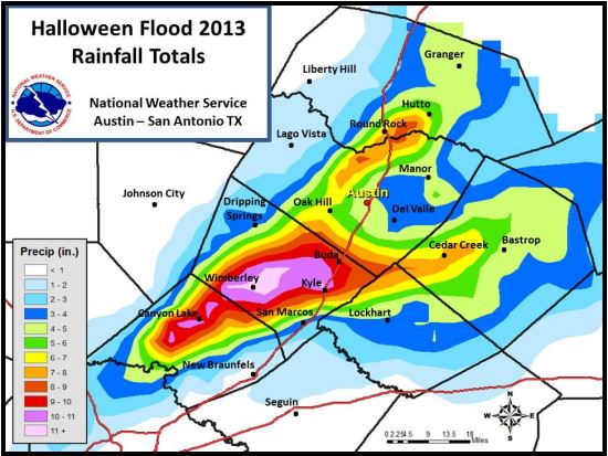
Map from NOAA.gov
|
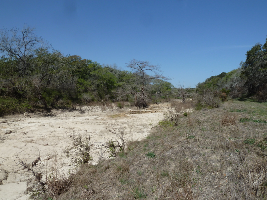
Photo by Corrin Turkowitch
|
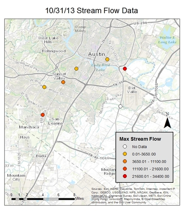
The two figures below show stream flow data for locations near Austin, Texas during the flash flood that occurred on October 31, 2013. The figure on the right displays the change of stream flow before and after the 31st, showing how extreme the change was when the flash flood occurred. On the 28th, none of the locations had stream flow above 400 cubic feet per second, while on the 31st, stream flow ranged from 3,700 cubic feet per second to almost 35,000 cubic feet per second. This data shows just how incredible the rainfall in had on local stream flow. Unfortunately, the instruments at the Onion Creek site failed to record stream flow data on the 31st, as can be seen in the figure on the left.
Created by Phillip Glodowski
|
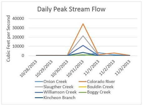
Created by Phillip Glodowski
|
